Cascade Trails available on Trailpeak http://www.trailpeak.com/index.jsp?cat=hike&con=article&val=1079*art
Trailpeak offers a great list of trails in the Cascade region. which offers trails virtually unknown to even its local residents around Hope. Hikers, mountain bikers or casual walkers will find trails suitable for every ability and interest.
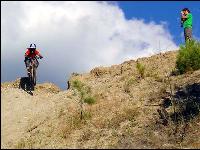
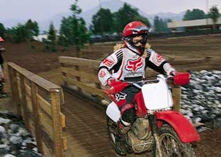
Newly constructed trails at Flood Falls provide a short hike to a cascading waterfall and a series of technically challenging downhill mountain-biking trails.
Other trails in the region offer breathtaking views of old-growth rain forest, deep canyon gorges and spectacular alpine meadows. The Needle, Silverdaisy, Mt. Outram and others are more technically challenging hikes into Alpine.
Kettle Valley Trail Round trip: 8 km Time: 2.5 hours Description: Located in the Coquihalla Canyon Provincial Park, this trail passes through a cool, quiet, wooded area leading to the Othello Quintet Tunnels. A popular Hope attraction, the tunnels were built between 1911 and 1916 as part of the Kettle Valley Railway. The tunnels provided the backdrop for the movie, Rambo: First Blood. This trail is flat and wide, making it ideal for biking. There are few obstacles or challenges. Directions: From the bear carving at Memorial Park head east on Wallace St. Turn right on Sixth Ave. Cross the railway tracks and turn left on Kawkawa Lake Rd. Turn right before the cemetery onto Kettle Valley Rd. Park at the end of the dirt road.
Flood Falls Round trip: 1.5 km Time: 30 min. Description: Just off the freeway, this short hike to a waterfall is perfect for families. There is also a mountain biking park, suitable for intermediate to advanced downhill mountain bikers. Directions: From Skinny's Grille take Flood-Hope Rd west 4 km to the overpass. Cross the overpass. Turn at the second left. Continue for 100 meters to locate the trailhead. For the mountain bike trails, drive to end of pavement and park. Continue along the dirt road around the ditch. The trail is clearly marked.
Trans Canada Trail One way: 96.9 km (whole trail: 5000 km) Description: Canada's premiere trail passes through this region. It runs from Paleface Pass, north along Silver Skagit Rd. It passes through the District of Hope and then along side the Coquihalla Highway, this section ends at the Coquihalla Lakes. The trail through out this area is complete; improvements will continue to be made with time and support.
Rotary Nature Trails Round trip: 2 km Time: 1 hour Description: Popular multi-use trails follow the Coquihalla River with great views of the Fraser and Coquihalla rivers. The trails overlook the golf course and are ideal for a casual walk, or moderate bike ride. Directions: From the bear carving at Memorial Park head east on Wallace St. Turn left on Fourth Ave. Continue to where Fourth becomes Wardle St. At the end of Wardle is an arched carving marking the trailhead.
Hope Lookout and Loop Round trip: 4 km Time: 3 hours Description: Perched upon a rockslide 500 metres up Mount Hope, hikers will experience an amazing view of Hope, including Kawkawa Lake and the Coquihalla and Fraser rivers. Mountain bikers will experience advanced downhill trails. Directions: From the salmon carving at Quality Inn head west on Old Hope-Princeton Way. Take the first left under the overpass and park at picnic tables. Follow a dirt road to the left. A sign for the trail is on the right.
Thacker Regional Park Round trip: 1 km Time: 15 minutes Description: This is a short walk winding through a marshland habitat. Complete with walkways and bridges, this ecologically sensitive area is filled with spawning salmon from late August to October. Directions: From the bear carving at Memorial Park head east on Wallace St. Turn right on Sixth Ave. Cross the railway tracks and turn left on Kawkawa Lake Rd. Turn left immediately after the bridge. This leads to a parking lot at the Salmon Spawning Area.
Hope Nicola Valley Loop: 8 km Time: 2.5 hours Description: Pioneers used this route to transport supplies between the Interior and the Coast. Great views overlook the Coquihalla River. A plaque commemorating the trail is located at the top. Directions: From the bear carving at Memorial Park head east on Wallace St. Turn right on Sixth Ave. Cross the railway tracks and turn left on Kawkawa Lake Rd. Bear right onto Othello Rd. and drive 3 km. Turn right onto Tunnels Rd. and park in lot. Walk through Othello Quintet Tunnels. About 300 metres past the last tunnel is a sign on the right marking the trailhead. The trail loops back to Tunnels Rd.
Mount Ogilvie Round trip: 5 km Time: 3.5 hours Description: The first section of this trail is wide enough to accommodate mountain bikers. It is steep in some sections. Directions: From the bear carving at Memorial Park head east on Wallace St. Turn right on Sixth Ave. Turn left on Kawkawa Lake Rd. Turn right onto Othello Rd. and continue for 6 km. The trailhead is on the left side.
Dog Mountain Round trip: Time: 1 hour Description: This trail climbs a short distance up the mountain through old-growth forest. It is ideal for hiking and mountain biking. Hiking beyond the trail is not advised due to the density of the forest. Directions: From the Info Centre head north on Water St. Follow Hwy #1 north. Continue over the Fraser River Bridge. After the second bridge, turn west on Hwy #7 towards Agassiz. Travel about 500 meters to the weigh scales and park at the far end. Cross the highway to locate the trailhead.
Eaton Lake Round trip: 8.2 km Time: 5 hours Description: This hike offers a variety of experiences. Once hikers reach Eaton Creek, the trail makes its way down to a log bridge, which provides a great view of the falls and creek. The trail leads up through second-growth forest scattered with flowers. Eaton Lake offers good fishing. Directions: From Skinny's Grille drive west on Flood-Hope Rd. Turn left on Silver Skagit Rd. marked with a single flashing traffic light. Continue along Skagit Rd. 16.5 km to the Eaton Creek Recreation Site to locate the trailhead.
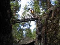
Ladner Creek Elevation gain: steep for first 100 m Round trip: 3 km Time: 1 hour Description: This walk along part of the historic Kettle Valley Railway leads over a collapsed tunnel to an old trestle bridge. Hikers should use caution when climbing and NOT cross the bridge due to uncertain structure. Directions: From the salmon carving at Quality Inn drive east on Old Hope-Princeton Way to Hwy #5. Travel east 22 km to Carolin Mines Exit. Turn left onto a dirt road and travel 2 km. Turn left immediately after crossing the bridge. Follow the road 1 km and park at the top beside the highway. The trail is located in a small rock fall to the left.
The Needle Elevation gain: 855 m Round trip: 13 km Time: 6 to 8 hours Description: This strenuous hike climbs to the peak at 2105 metres. The view from the top looks over the Cascades to the Coastal Mountains. The Needle is recommended for experienced hikers only. Directions: From the salmon carving at Quality Inn head east on Old Hope-Princeton Way. Take Hwy #5 east for 46 km. Use the service road near the Ministry of Highways yard. Park on the side near the sign that marks the trailhead.
Skagit River Trail One-way: 13 km Time: 6 hours Description: This walk in the woods passes through an ecological reserve of old-growth forest. In June (the best time to use this trail), wild Rhododendrons come into bloom. Directions: From the salmon carving at Quality Inn drive east on Old Hope-Princeton Way. Take Exit 177 onto Hwy #3 toward Manning Provincial Park. Continue 29.5 km and park at the Sumallo Grove Picnic Area on the right. The trail is clearly marked.
Dewdney Trail One-way: 36 km Time: 2 days Description: Named after its constructor Edgar Dewdney, this trail has a history dating back to 1860 and was once a vital trade route linking the Coast to the Interior. Panoramic views of valleys and mountains can be seen along the trail. Directions: From the salmon carving at Quality Inn drive east on Old Hope-Princeton Way. Take Exit 177 east onto Hwy #3 toward Manning Provincial Park. Following highway signs, continue 2.5 km past Sumallo Grove Picnic Area to the Cascade Recreation Area. The trailhead is clearly marked.
Whatcom Trail Elevation gain: 650 m One way: 17 km Time: 14 hours Description: The Whatcom Trail begins 2.5 km from the Dewdney Trail. This full day's adventure passes through second-growth forest and meadows at Whatcom Pass and the Punch Bowl. The trail heads down to the Tulameen River and through Paradise Valley. Best hiked during July to September. Directions: From the salmon carving at Quality Inn drive east on Old Hope-Princeton Way. Take Exit 177 east onto Hwy #3 toward Manning Provincial Park. Following highway signs for 2.5 km past Sumallo Grove Picnic Area to the Cascade Recreation Area. The trail is clearly marked.
Silverdaisy Mountain Trail Elevation gain: 1435 m Round trip: 20 km Time: 9 hours Description: Once across the Skagit River at the Sumallo Grove Picnic Area, hikers climb switchbacks until reaching a slope overlooking the Skagit Valley. Following an old mining tram, the trail goes left up from the saddle, through a meadow before reaching the top. Directions: From the salmon carving at Quality Inn drive east along Old Hope-Princeton Way. Take Exit 177 east onto Hwy #3 toward Manning Provincial Park. Continue 29.5 km to the Sumallo Grove Picnic Area. The trailhead is on your right hand side. Note: This trail is best hiked from July to September.
Spirit Caves Elevation gain: 500m Round trip: 5 km Time: 3 hours Description: This trail has steep switchbacks leading to a view of Yale and the Fraser River. At the top the caves can be accessed but are hidden by large rocks. Directions: From the Info Centre head north on Water St. and follow Hwy #1 to Yale. Park at the Spirit Caves sign on the left, located 23.5 km from Hope.
Mount Lincoln Trail Elevation gain: 580 m Round trip: 5 km Time: 3 hours Description: Hikers must use the fixed ropes to ascend a steep hill. The top provides a view of Yale and the Fraser Canyon. Directions: From the Info Centre head north on Water St. and follow Hwy #1 23.5 km to Yale. Drive through Yale, past the Tempo Gas Station. Parking is on the right after a small bridge before the tunnel. Cross the road to a large rock and continue climbing. Note: Water is scarce in this area so hikers must bring a supply.
Alexandra Bridge Round trip: Time: 30 min. Description: Constructed for the Cariboo Wagon Road, Alexandra Bridge was built in 1926 to replace the suspension bridge that hung across the Fraser River since 1863. This short trail goes down into the canyon and crosses the bridge. Directions: From the Info Centre head north on Water St. and follow Hwy #1 48 km north past Spuzzum. This trail starts at the Alexandra Bridge Provincial Park, located on the left side of the highway.
First Brigade Trail Elevation gain: 760 m Round trip: 13 km Time: 6 hours Description: This former pack trail climbs steeply from the Fraser Canyon to Gate Mountain. Hikers begin beside a stream. The trail passes a series of small lakes, heading uphill to a viewpoint from some bluffs. The trail emerges near a rock bluff, providing a view of the Fraser Canyon. Directions: From the Info Centre head north on Water St. and follow Hwy #1 north for 50 km, passing Spuzzum. The trail is located just north of Alexandra Lodge; use the parking lot 100 metres beyond, walk back to the trailhead.
Other Hope area trails that also exist on trailpeak include:
22. Pacific Crest Trail
23. Zoa Ridge - Coquihalla
24. Falls Lake
25. Skyline-2
26. Heather Trail - Manning Park
27. Lightning Lakes - also in Manning Park
When one includes all the trails that Manning park has to offer, the Hope/Manning area in the Cascades add up to a great reason to venture out of the city and into the mountains.
(30)

