Hiking in Mount Revelstoke National Park offers you the chance to explore the rugged Columbia Mountains. Mount Revelstoke's 10 trails range from short, valley-bottom strolls, to steep, tough climbs. Some offer spectacular panoramic views of mountains from subalpine meadows lush with wildflowers, while others wind through stands of old-growth cedar-hemlock forests.
Whatever trail you choose, come prepared for travel in a rugged mountain environment and unpredictable weather. Ask for the free annual publication, the "Selkirk Summit", which contains a map and information on trails. The publication Footloose in the Columbias, available from the Friends of Mount Revelstoke and includes details on trail length, hiking time, difficulty, elevation gain and special features. Voluntary registration is available
Self-guided Trails
Giant Cedars Boardwalk Trail
A one half kilometre boardwalk takes you into the heart of the park's old-growth forest, among cedar trees that may be more than half a millenium old. Signs along the way relate the importance of functioning ecosystems. Benches are provided so you can relax and breathe in the serene forest atmosphere. Trail head is at the Giant Cedars Picnic Area, 30 km east of Revelstoke on the Trans Canada Highway. This trail is being rebuilt in 2002, re-opening in spring 2003!
Skunk Cabbage Boardwalk Trail
A 1.2 km trail and boardwalk lead you over a swamp inhabited by muskrat, beaver, skunk cabbage and a host of birds. Signs help you identify the plants and animals you see along the way. This fascinating place is at its best from May through July. Trailhead is at the Skunk Cabbage Picnic Area, 28 km east of Revelstoke on the Trans Canada Highway.
Meadows-in-the-Sky Trail
One kilometre of paved trail takes you through a sub-alpine meadow. Signs provide information about this fragile area where winter lasts up to nine months of the year. A point of interest is the Icebox, a shaded rock cleft where snow persists throughout the summer. This trail is at its best in late July and early August when the wildflower blooming season is at its peak. Trailhead is at the summit of Mt. Revelstoke, a 26 km drive from the town of Revelstoke.
Bicycling
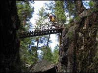
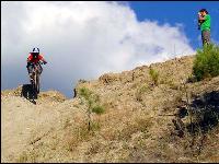
Cycling is allowed on the Trans-Canada Highway and the Meadows in the Sky Parkway, as well as the Two Km and Five Km trails at the foot of Mount Revelstoke. A connector trail links these trails with Highway 23 North.
Ski Touring, Cross-country Skiing and Snowshoeing
The Meadows in the Sky Parkway is left unploughed in the winter, and track is set to the Monashee Picnic Area, eight km up the road. Ski-tourers can continue on beyond the track -set trail, or use the Summit Trail to overnight at Caribou Cabin (20 km). Every January around the full moon, the park and the Friends of Mount Revelstoke and Glacier host the annual Moonlight Ski.
The spectacular terrain and heavy snowfalls of the Selkirk Mountains combine to produce some of the best ski touring opportunities in North America. Voluntary registration is recommended.
This is avalanche country. Phone (250) 837-MTNS or check the local avalanche forecast. Winter travelers venturing beyond trackset areas must be knowledgeable of avalanche terrain and have appropriate training to ensure their own safety and their self-rescue capability.
Mountaineering
The granitic peaks of the Clachnacudainn (pron. CLAK-na-KOO-din) Range east of the summit of Mount Revelstoke offer good scrambling and Class 4 climbing. A locally-popular rock face known as the Lauretta Slabs is accessible within a short distance of the Trans-Canada Highway.
Climbing requires special skills and equipment. For advice on routes and conditions, contact the Warden Service in Revelstoke (250-837-7500).
The booklet Footloose in the Columbias, available from the Friends of Mount Revelstoke and Glacier at their store in the Rogers Pass Centre or through their website contains information on access routes, as does the American Alpine Club Climber's Guide to The Columbia Mountains of Canada Central (1992), ed. John Kevin Fox (The AAC Press, 113 East 90th Street, New York 10128).
Hiking in Glacier National Park offers a challenge - the chance to explore a portion of the rugged Columbia Mountains. First set aside as a federal reserve in 1886, the area around Rogers Pass was considered the key link in the newly constructed transcontinental railway which ushered in an era of easy access to the Columbia Mountains. A golden age of mountaineering followed and most of the trails in use today were constructed at that time.
The many glaciers and avalanche paths indicate winters of great snowfall. The climate is usually cool and wet, but summers can be hot and humid. Snowpacks linger in shaded areas along some of the trails. Exercise extreme caution in crossing snowpacks on steep slopes and consider carrying an ice axe, or avoiding the slope if it is icy.
Administered jointly with Mount Revelstoke National Park, these protected areas are managed in such a manner as to ensure the continuance of the splendour and richness of our natural and cultural heritage. These parks are home to a great diversity of wildlife including 54 species of mammals, 183 species of birds and 686 species of plants.
The trails described here range from short, level strolls to ambitious climbs. Some offer dramatic mountain views, while others wind through stands of ancient giant trees or probe the secrets of the abandoned railway over Rogers Pass. Whatever your interest and physical ability, hiking is the best way to get to know one of Canada's distinctive natural regions - the Columbia Mountains.
Balu Valley Restricted Access
Important Information for Backcountry Visitors in Glacier National Park: As of July 2004, hikers in Balu Valley in Glacier National Park are required to travel in groups of at least six persons when the “Restricted Activity Notice” is in effect. This restriction will be in place for the season when park wardens detect bears using the valley. This restriction is based on a similar program instituted in the Larch Valley area of Banff National Park since 2000. This restriction is a legal requirement in Balu Valley only. Park visitors are asked to comment on the effect of this restriction to their backcountry experience by completing a comment sheet at the Rogers Pass Discovery Centre or at the park office in Revelstoke.
Balu Valley has a well known history of bear use. The five km long trail crosses many avalanche paths used by bears for feeding. Two bear mauling incidents occurred here in 1971. Since then, park wardens have frequently posted warnings or closed this trail to hikers when grizzlies were detected in the area. It is hoped that controlling group size will reduce the need for Area Closures. Park wardens will conduct patrols to monitor the effectiveness of this program.
Trail use monitoring indicates that the number of people hiking the Balu Trail has increased in recent years and that this trend is likely to continue. The restriction on group size is based upon experience gained from other parks. The number six drives from University of Calgary Professor Stephen Herrero’s research on risk factors to backcountry travellers in bear habitat, which showed a much lower incidence of bear attacks on groups of six or more. Larger groups make more noise, so are perceived sooner by bears giving them more time to move off. As well, grouping hikers reduces the number of times that a bear will be disturbed by humans.
A group of six hikers means that members of the group are sufficiently close together to be able to converse with all members of the group at all times. Should an encounter occur, it is vital that the bear perceive a tight group, not individuals spread out along the trail.
Bears that use habitats adjacent to areas of high levels of human activity are at risk of losing their natural fear of people. For this reason, the Cougar Valley was closed entirely to hiking in 1996. Radio-telemetry data from bear research indicated a concentration of use there by at least two female grizzlies. The closure was instituted to keep to park visitors from entering a potentially dangerous situation as well as to give female grizzly bears a place where they would not be disturbed. Disturbance causes bears to defend their territory or to leave the area. Neither outcome is desirable for fostering public safety or maintaining ecological integrity.
Viable populations of grizzly bears indicate a healthy, sustainable ecosystem because they require true wilderness to live. Many other species benefit indirectly from efforts to maintain grizzly bears. The Park Management Plan commits Parks Canada to mitigate impacts to ecological integrity.
Grizzly bears are a threatened species and must be conserved in the park as much as possible. The area of North America formally occupied by grizzlies has been greatly reduced since European settlement. Parks like Glacier are a refuge for bears. Other actions by the park to accommodate people and bears include bear proof garbage containers, trucking all park garbage to a fenced landfill site, cutting back vegetation to maintain sightlines along hiking trails, and educational programs.
For a quick course on how bears live and how people can avoid problems with bears, read the booklet “Traveling Safely in Bear Country,” available from the Friends of Mt. Revelstoke and Glacier, or visit http://www.cmiae.org/ and click on “Bear Ecology for Safe Hiking in the Columbia Mountains.”
Hiking Trails in Glacier National Park
Illecillewaet Campground
Eight hiking trails lead from the Illecillewaet Campground up the Illecillewaet and Asulkan valleys. These trails range from the 1-km Meeting of the Waters trail, a gentle loop stroll through the woods past the junction of the Asulkan and Illecillewaet streams, to all-day, knee-pounding, grinds of more than 1000 m elevation gain up to spectacular alpine ridges and viewpoints. This collection of trails makes a stay at the Illecillewaet Campground a hiker's dream vacation! Read on for a virtual hiking experience. Don't forget to check the Safety and Weather sections of this website if you decide to go for a hike here!
- Meeting of the Waters Trail

