Skaha Climbing Bluffs
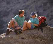
Skaha Bluffs are a collection of gneissic cliffs on the east side of Skaha Lake just South of Penticton. The area overlooks the City and provides beautiful views of the Okanagan Valley. Travel to the Bluffs requires only a ten-minute drive plus a thirty-sixty minute walk (depending on walking speed and which area is to be reached).
Area Access
At this time, the only access to the Bluffs is via Braeside Farm. There is a fee of $5 per day or $50 per season and this is basically an access fee, not a parking fee.
Please do not park on Valleyview Road as it annoys the residents. Carpooling from the beach to the farm is an excellent alternative and can help reduce your costs.
The daily fee at Braeside Farm is to be placed in an envelope and deposited in the drop box beside the notice board on site. Season passes may be purchased from:
Ray's Sports Den
#101 - 399 Main Street,
Penticton, BC
V2A 5B7
(250) 493-1216
http://www.penticton.ca/maps/SkahaBluffMap.asp
Mt. Kobau
This trail is mostly on an old logging road, with a number of possible scrambles up or down between switchbacks. About a kilometre in or so the Okanagan Valley starts to appear through the trees, the view getting better and better as you get higher. At the top you get a un obstructed view of Osoyoos and many beautiful orchards. There is GPS data attached to this trail, which if loaded into your GPS can help you find route points.
To get to the base of this trail, drive west from Osoyoos on Hyw 3 following it to the top of the hill. On the right you will pass a gravel pit, and just past this turn right up the back road. You can follow this for quite some time if you have 4X4 but the further you drive, the shorter you stroll. A good place to park is about 1.5 km in, where there is a sign with a map of the area. It is 22 km from the highway to the summit, and depending on how far you drive in will determine how long it takes to complete the trail.
It takes about a day and half to cover this trail which is considered of average activity level.
Penticton Channel Path
Located in Penticton, this 12 km (return) Channel pathway, follows the canal from Okanagan Lake to Skaha Lake. This is a short easy bike ride or can be walked or even used for jogging. It's just over 6 kilometers from one end to the other.
Directions:
Park at either in. There is a parking lot off Skaha lake road in the south end or near the SS Sicamous restaurant in the north end.
Canyon View Trail
This is a Provincial Trail run by the Ministry of Forests and is 2 km in length. The highlight is that it serves as an interpretive trail for the large Garnet Fire in 1994. There is GPS data attached to this trail, which if loaded into your GPS can help you find route points.
Directions:
The Trail is 9 km. west of Penticton. Take Carmi Road until you reach Beaverdell Road. Turn right on Beaverdell and continue for a few more kilometres and it will be on your right.
Giant's Head Mountain
Giant's Head Mountain is located in Summerland, BC. Trail is steep in places but no climbing is required. Length is 1.6 KM from trailhead to summit and elevation gain is approx 350 m (1050 ft). Time from base to top is approx 25-40 minutes and 20-30 minutes coming down, depending on ability of hikers. Not recommended for dogs (you are in direct sunlight all the way and no watering holes). In short, a good quick hike to get your heart rate up and with a beautiful view of the Okanagan at the top.
Directions:
Trailhead is about 100m up Milne Rd at Giant's Head Rd
KVR - Naramata
The Kettle Valley Railway right-of-way has become a favourite travel route because of its easy grades and spectacular scenery. the length of this portion of the trail is about 60 km. The Rock Ovens, two tunnels and the cool oasis of Chute Lake Resort are highlights of this trail loop which takes about 4 hours to bike. Rock Oven Park contains several interesting features of historical significance. The rock ovens were constructed along the Kettle Valley right-of-way above Naramata, built between 1911 and 1915. To locate them, watch for a wide spot in the grade just before it enters a rock cut. You can follow a fairly well-used trail up the hillside to a fine specimen of the rock ovens that once served the railway construction crews.
One of the most spectacular viewpoints is at the mouth of Little Tunnel. Below to the south, the scattered ponderosa pine and bunchgrass gives way to the neatly manicured orchards of Naramata and then the beaches and cityscape of Penticton. Skaha Lake disappears around the bend on the horizon.
The 489 metre long Adra Tunnel carves a curve within the mountain and a weak spot in the roof near the mid-point is slowly caving in. The tunnel is barricaded and a hiking/biking trail bypasses it.
Excerpts quoted from Okanagan Trips & Trails, A Guide to Backroads and Hiking Trails in BC?s Okanagan-Similkameen Region. See this site for details.
Directions:
Travel to Penticton via Highway 97, turn east onto Westminster Avenue and follow this road through to Naramata. There are many access points for this section of the trail. The best place to connect with the Kettle Valley Rail in this area is at Smethurst Road located east off Naramata Road, just past the main turnoff down to Naramata. A second access point is at Arawana Road also located east of Naramata Road. An access point further down the line is located where the KVR transects Chute Lake Road at the three km mark.
KVR- Penticton
The section of track from the Summerland south to Trout Creek has been recreated and has a replica KVR passenger train that runs in the summer months. Past Trout Creek the KVR trail runs on top of clay cliffs overlooking Okanagan Lake, before dipping down into the City of Penticton.
Leaving Vancouver Place (at the northeast edge of Penticton) toward Naramata expect to pass over Andrew McCulloch trestle with some beautiful views of the Okanagan Valley. Between these two communities there are nine little wineries and vineyards to take in along the way. This section of the KVR is about 40 km and takes about 5 hours to bike.
Directions:
Penticton can be used as a hub to access three direction of the Kettle Valley Rail trail. To get to Summerland from Penticton using this trail, park on Green Mountain Road west of Highway 97 just after crossing the Okanagan River Channel. Follow the Channel Pathway north to where this trail transects the KVR. An old bridge over the channel, which is now removed, makes this location quite distinct. At this point turn west which will take you to Summerland. Traveling south will take you to Kaleden.
While in Pentiction, to travel to Naramata via the KVR trail, turn onto Westminster Ave off Highway 97 and continue through town up Vancouver Ave and turn left onto Vancouver Place. Starting your hike from Naramata the best place to park your vehicle is at the junction of Smethurst Road and the KVR off Naramata Road.
Nkwala Mtn / Jerry Mtn - DH
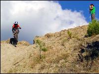
Located in the Penticton area this is about a 40 minute bike climb to the Nkwala Saddle overlooking trout creek and Penticton. From there you can either keep climbing to the tower or enjoy the nice bomb down to the west bench. this is considered a singletrack downhill. Lots of fun turns and a couple jumps.
Directions:
Start at the Summerland KVR Trestle just past summerland sweets. Go over the trestle and after about 2km there is a trail exiting to the right.
When you reach the saddle you can either continue up the road to the Radio Tower or cut off the trail to the left. The trail to the left is the start of a really fun downhill bomb that ends up in the west bench near the sage mesa golf course. You can then ride back to Summerland or you can begin and end your loop in Penticton.
The Rim
This trail is part of a network of trails in the Cathedral Lakes Provincial Park. Starting at the lodge, the trail winds around the lake and through the campsite and then up into the alpine meadows. You have 2 routes to choose from. you can take the route past Glacier Lake and up onto the Rim. Once on the rim you have unlimited viewing of the Coastal Range. Mt Baker and Mt Rainer are easy to spot. Mountain goats and hoary marmots share the trail in many spots.
Directions:
From Keremeos drive over the red bridge and follow the river to the parking compound. Make sure you have reservations on the shuttle buggy, which leaves at 10 am. The trip up the mountain takes just over an hour. If you want to hike the 10 km trail it will take you a good 8 hours.
Pay the $75.00 and get to the alpine right away!!!!
Esplanade Trail Network
The Esplanade Trail Network is about 2 km in length and an easy hike into habitat diverse in vegetation and habitat. To maintain this naturally sensitive area, trail users should stay on formal trails. These trails provide better accessibility, improve habitat for plants and wildlife, and create physical barriers in the event of a grass fire. The trail runs along Okanagan Lake and leads to the Trans-Canada Trail and 3Mile beach(3Mile also has a C/O section just past the large willow tree on the north end if anyone is interested). This is a nice nature hike or mountain bike trail.
Directions:
Head for the Penticton Yacht Club (on the North East end of Penticton) the trail is at the south end of the Yacht Club can't miss the sign. Lots of parking.
Anarchist Mountain
This trail offers many views of the western portion of the Okanagan Valley and Osoyoos Lake. You can veer off this trail and hike your way to the summit of Anarchist Mountain, which at an elevation of 1480 metres, gives a panoramic view of the surrounding valleys. Additional trails are located on Anarchist Mountain and offer spectacular westerly views of Osoyoos Lake. You can expect to pass through canyons of large ponderosa pine, Douglas fir and aspen groves. Additional trails located on Anarchist Mountain for exploring include: Long Joe Road, Long View Road, Chapman Road, Ponderosa Pass, Granite Gorge, Peregine Place, Border, The High Road, Panorama Ridge, Nine Mile Creek, and Sidley Meadow. Trail descriptions and directions for all these trails can be found at www.rdos.bc.ca
Directions:
Travel east of Osoyoos for 17 km on Highway 3, then turn north on Lamont Road. The Over The Top trailhead will be on the right. After 2 km, follow this trail for 600 metres and if you take the left side of the fork you are now on your way. The second option is to travel east of Highway 3 for 24 km and turn left, north of the gate, park here and start your hike on the High Road Trail. Follow the trail for 2 km and then turn right and make your way around Anarchist Mountain.
The Regional District of Okanagan-Similkameen's Trail Inventory is a trail information database that will provide you with a wealth of information about existing trails. We hope you find the website informative and easy-to-use.
http://rdos.bc.ca/index.php?id=141
Penticton Outdoors Club
We are a club of people who enjoy self propelled outdoor recreation. We share our knowledge of favourite hiking & skiing trails in the South Okanagan area.
Throughout the year we schedule weekly 3 1/2 to 5 1/2 hour long "hiking" or "touring skiing" trips; aiming to reach spectacular viewpoints along routes we have pioneered to make them as interesting and "user-friendly" as the terrain allows. These are usually on Saturdays; with mid week "work parties", or "exploratory trips" by small numbers of "keeners". There is a constant seasonal change in our destinations, with the lower canyons and ridges hiked in spring and fall; and the high alpine in mid summer. Every two to three months we hold social "planning meetings" in different members homes, to work out leaders, destinations and dates for our outings. We always welcome new members. There is a nominal annual fee of $7.00. All we require are: good boots, a comfortable light back pack, adequate water, reasonable fitness, and a friendly smile.
http://www.pentictonoutdoorsclub.ca/
The International Bicycling and Hiking Society of Oliver welcomes outdoor recreationalists from around the world to come and enjoy our trail along the scenic Okanagan River. Stretching from McAlpine Bridge (where the Okanagan River and Highway #97 intersect north of Oliver) to the head of Osoyoos Lake the "Hike and Bike" trail measures 18.4 kms in length.
http://www.oliverchamber.bc.ca/to_do/recreation/bike_hike/bike_hike.htm
Nickel Plate Nordic Centre
http://www.nickelplatenordic.org/
The Meadowlark Festival
The Meadowlark Festival was initiated by the Okanagan Similkameen Conservation Alliance (OSCA) to encourage people of all ages to experience, discover and explore our natural environment. The Okanagan-Similkameen hosts a rare mosaic of natural habitats, among them is one of Canada's most endangered ecosystems - the hot, dry shrub-grasslands. A spring-time look at these shrub-grasslands, known as Canada's 'pocket desert', reveals a riot of colour flourishing in this seemingly harsh environment.
The weekend festival is a celebration of the unique wildlife and habitats found in Penticton and surrounding areas. More than 100 distinct types of wildlife habitat are home to some of the most diverse and rare assemblages of plant and animal species in BC and Canada.
http://www.meadowlarkfestival.bc.ca/


